
Introducing AgEagle’s RedEdge-P dual: 10-band high-resolution multispectral and RGB composite drone camera.
The dual solution seamlessly integrates the RedEdge-P and the new RedEdge-P blue cameras for mirroring Landsat 8 and Sentinel-2 satellite bands in just one flight and at a higher resolution of 2 cm / 0.8 in per pixel at 60 m / 200 ft, enabling direct comparison between drone and satellite imagery.
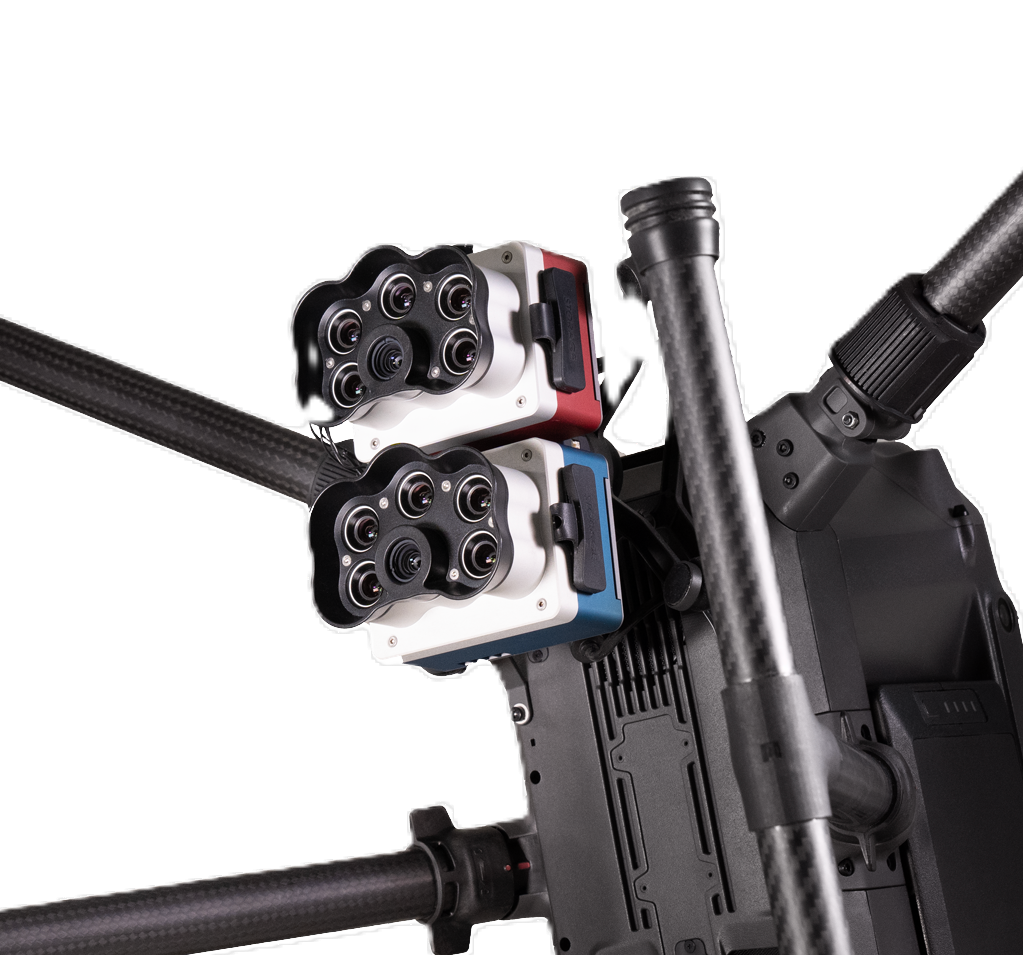
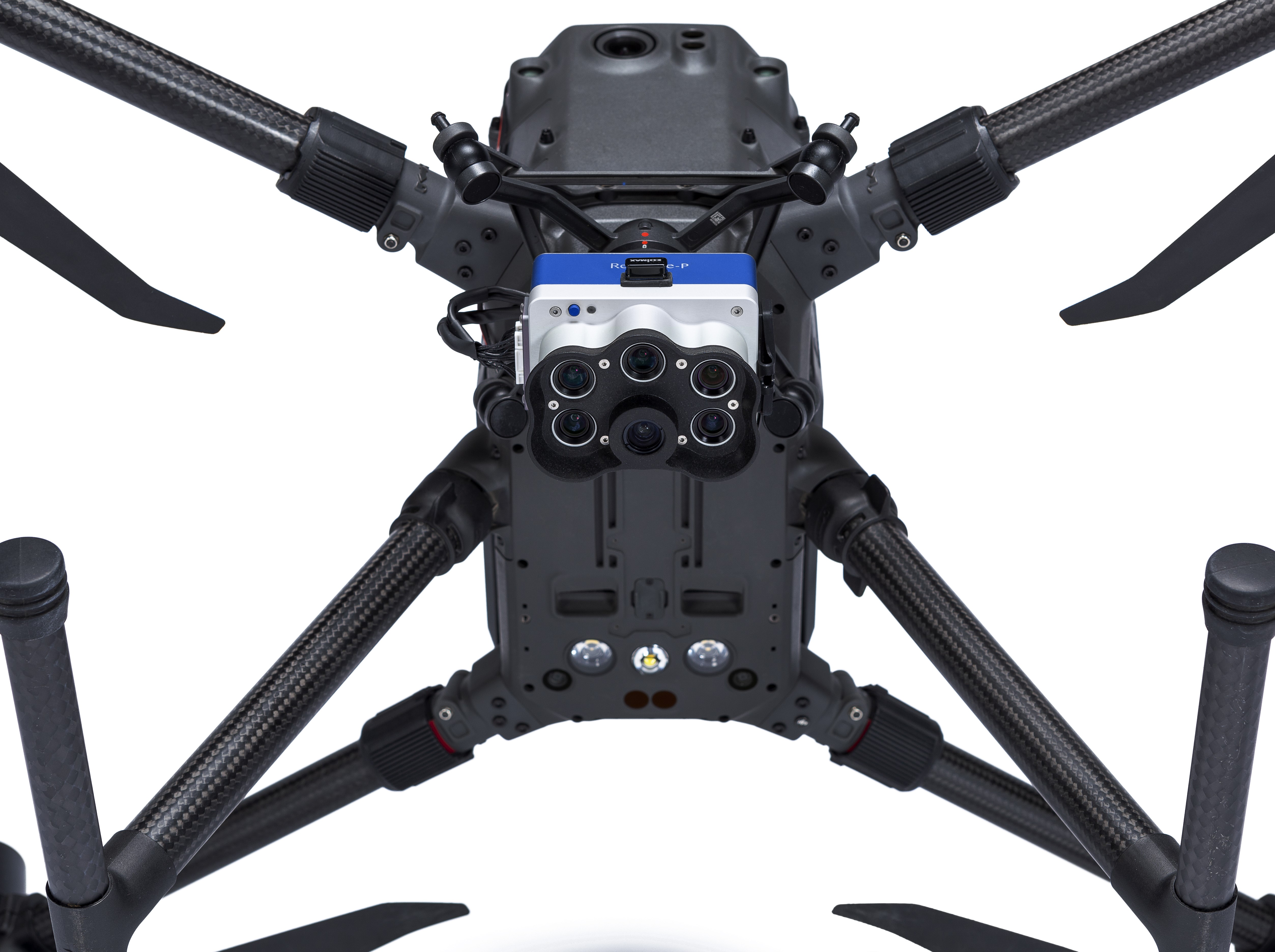
The RedEdge-P dual doubles the analytical capabilities, but with the benefit of a single camera workflow. It is compatible with the DJI Matrice 300 drone and with most standard flight planning and post-processing software, like Pix4D, Agisoft or Measure Ground Control. Allows for various outputs, such as RGB, NDVI, NDRE, OSAVI, NIT, CIR, DSM, and more. 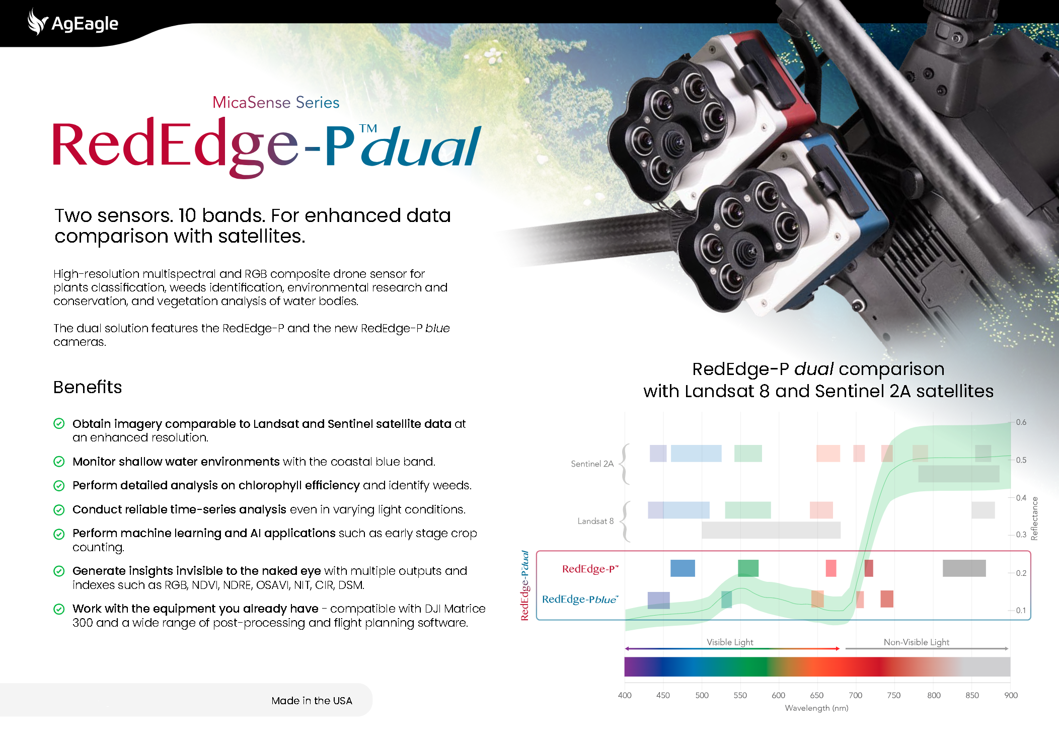
Features
• 10 multispectral bands at 1.6 MP each for Landsat 8 and Sentinel-2 satellite data comparison.
• Pan-sharpening technology for enhanced spatial resolution imagery of 2 cm / 0.8 in per pixel flying at 60 m / 200 ft compared to satellites at ~10 m / 32 ft per pixel.
• Coastal blue band specially designed for water vegetation analysis and weeds identification.
• Double radiometric calibration with DLS light sensor and CRP calibration reflectance panel for accurate and reliable data in varying light conditions.
• Global shutter on all 10 lenses that withstands vibration without degrading image quality for distortion-free image capture.
• Narrow bands for enhanced data accuracy.
• Fast capture rate: 3 raw DNG images per second with a single CFexpress SD card of 128 GB.
• Synchronized capture of all 10-bands, automatic triggering and geotagging of images for efficient flight times and easy post-processing.
• MicaSense series sensors are employed at academic, private, and government institutions worldwide since 2014.
Main Applications
Vegetation analysis of water bodies: perform surveys over water for chlorophyll efficiency examination, vegetation analysis and identification of algae or floating, submerged and emergent plants.
Environmental monitoring: coastal and near-shore mapping for water resources management, tidal zones, swamps and glacier monitoring.
Water management: public water supply surveillance, water resources management.
Habitat monitoring, protection, and restoration: erosion and biodiversity inspections, reef surveys over shallow waters, inaccessible to vessels and sensitive to human interaction.
Vegetation species and weeds identification: vegetation health management and species identification, including the ability to differentiate and count plants, trees, invasive species, and weeds.
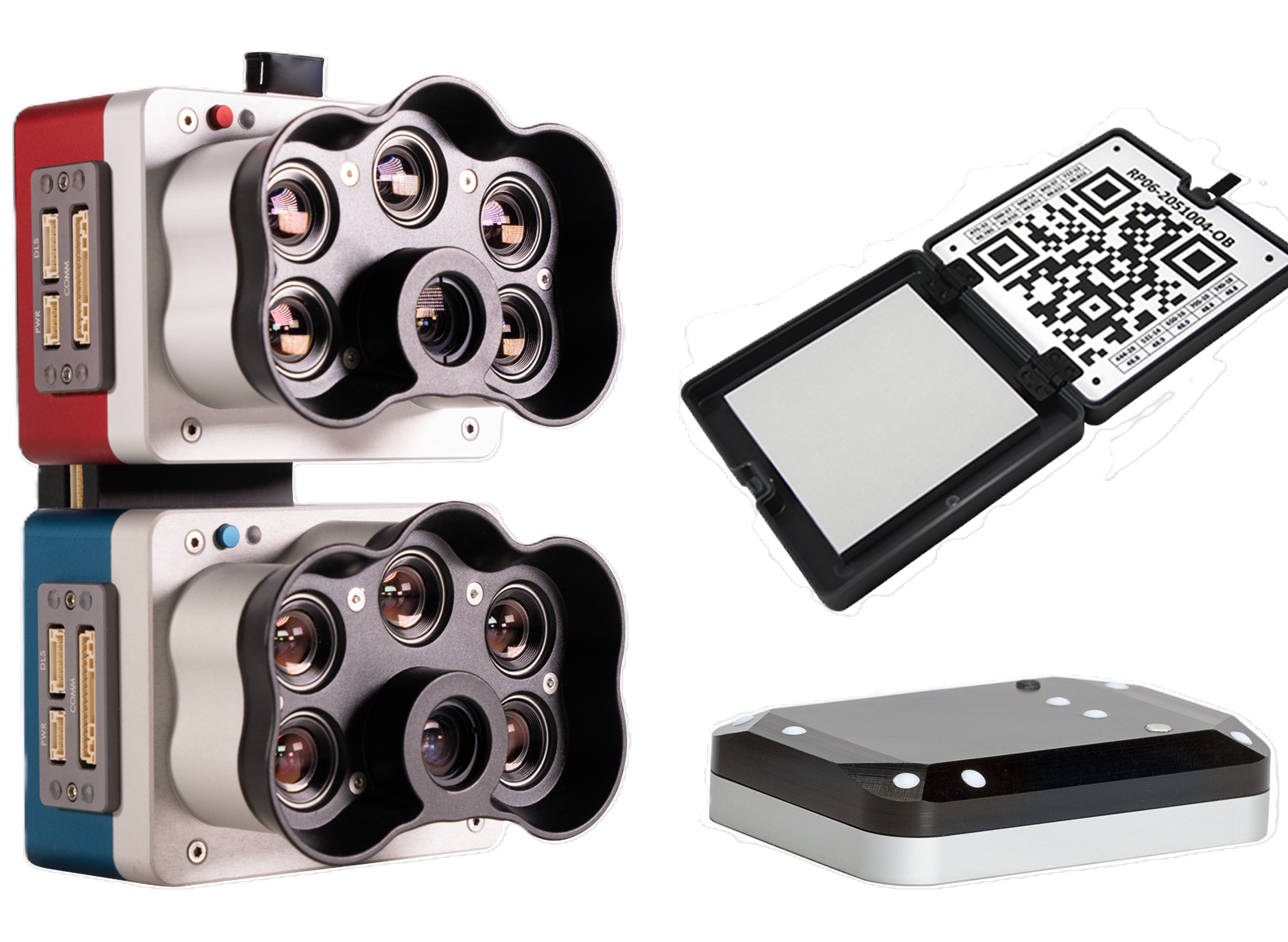
Kit Contents (RedEdge-P dual)
• RedEdge-P
• RedEdge-P blue
• Quick Mount for DJI M300 drone
• CRP2 reflectance panel
• DLS2 light sensor
• USB Wi-Fi dongle
• Lens cover
• Integration cables
• Mounting hardware
• CFexpress Card
• CFexpress Card reader
• Hard carrying case
Kit Contents (RedEdge-P blue)
• RedEdge-P blue
• CRP2 reflectance panel
• DLS2 light sensor
• USB Wi-Fi dongle
• Lens cover
• Integration cables
• Mounting hardware
• CFexpress Card
• CFexpress Card reader
• Hard carrying case
*Mount not included. Sold separately based on the drone used.
*DJI SkyPort mount allows for RTK support for DJI Matrice M300 drone and triggering and controlling the camera through DJI’s flight planner.
*Upgrade Kit available, Contact us for more info.
Specifications RedEdge-P dual
Weight
745 g / 26.2 oz (two sensors, mounting hardware, DLS, and cable)
Dimensions
13.2 cm x 8.8 cm x 9.67 cm / 5.1 in x 3.1 in x 3.5 in
Spectral bands
Coastal blue 444(28)*, Blue 475(32), Green 531(14)*, Green 560(27), Red 650(16)*,
Red 668(14), Red Edge 705(10)*, Red Edge 717(12), Near-IR 740(18)*, Near-IR 842(57)
*Denote RedEdge-P blue bands.
RGB output (with appropriate post-processing)
5.1 MP (global shutter, aligned with all bands)
Sensor resolution
1456 x 1088 (1.6 MP per multispectral band)
2464 x 2056 (5.1 MP panchromatic band)
Ground sample distance
7.7 cm / 3 in per pixel (per multispectral band) at 120 m / ~400 ft AGL
3.98 cm / 1.5 in per pixel (panchromatic band) at 120 m / ~400 ft AGL
Field of view
50° HFOV x 38° VFOV (multispectral), 44° HFOV x 38° VFOV (panchromatic)
Capture rate
Up to 3 images per second raw DNG
Storage
CFexpress card
Interfaces
Three configurable GPIO: select from trigger input, PPS input, PPS output, and top of
frame signals. Host virtual button. USB 2.0 port for WiFi. Serial. 10/100/1000 Ethernet.
External power
7.0 V - 25.2 V
Power input
11/14.0/20W (standby, average, peak)
Heat
Ambient without airflow: 0-40 °C / 0-104 °F
Ambient with airflow >0.5 meter per second / >1.1 mph: 0-50 °C / 0-122 °F
IP rating
IP4X
* With appropriate post-processing
Note: Specifications are subject to change without notice
